






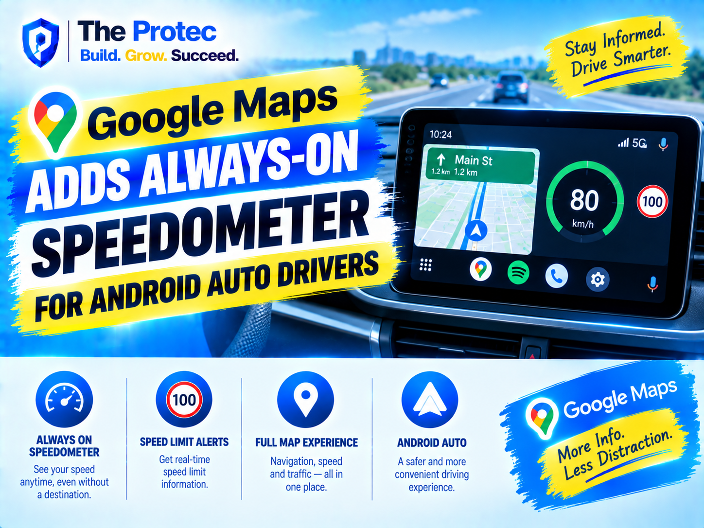
Google Maps is becoming more useful in the car even when you do not need directions. A new Google Maps Android Auto speedometer behavior keeps your current driving speed visible while Maps is open, including trips where no destination has been entered and turn-by-turn navigation is not running.
The change sounds small, but it addresses a common Android Auto habit. Many drivers leave Google Maps on the infotainment screen during familiar journeys to monitor traffic, nearby roads and possible disruptions. Previously, some of its most helpful driving information was closely tied to an active route. The Android Auto always-on speedometer makes the map screen more informative from the moment a drive begins.
Alongside speed-limit information and traffic alerts where available, the update moves Google Maps closer to a general-purpose driving dashboard rather than an app used only for navigation.
What Changed With the Google Maps Android Auto Speedometer?
The key difference is that the Google Maps speed display no longer necessarily requires active navigation. When the updated behavior is available, opening Google Maps through Android Auto can place a small speedometer on the map while the vehicle is moving, even if the search field is empty and no route has been calculated.
Before this change, drivers were more likely to see driving-speed information after choosing a destination and starting guidance. Without a route, Maps primarily acted as a passive map showing the vehicle’s position. The new Google Maps speedometer always-on experience gives that passive view an additional purpose.
This does not mean navigation secretly starts in the background. With no destination, there are no turn instructions, route-specific lane recommendations, arrival estimates or automatic rerouting prompts. Maps simply continues following the vehicle on the map and displays useful driving context.
How the Always-On Speedometer Works
The Google Maps driving speedometer uses location and movement data from the connected Android phone and the broader Android Auto environment to estimate the vehicle’s current speed. It appears as a compact digital readout within the Maps interface, designed to remain readable without taking significant space away from the map.
Its behavior is similar whether Android Auto is connected by USB or wirelessly. Once Google Maps is active on the vehicle display, the Android Auto speed display can remain visible as the map follows the car. The precise position and styling may vary with screen dimensions, display resolution, regional settings and interface updates.
Drivers who already had the Google Maps speedometer enabled for navigation may find that the same preference now applies outside an active route. Relevant controls are generally available in Google Maps navigation settings on the connected phone. If the display is missing, check that the speedometer option is enabled, update Google Maps and reconnect Android Auto.
Because the measurement is based on location data, it may react more slowly than a vehicle’s instrument cluster when accelerating, braking, entering a tunnel or driving where satellite reception is weak.
What Google Maps Shows When There Is No Destination
The Android Auto speedometer without navigation adds information without turning an ordinary commute into a guided trip. In the Google Maps speedometer no-destination mode, drivers may see:
- The vehicle’s estimated current speed
- A posted speed limit where reliable local data is available
- Traffic coloring on surrounding roads
- Icons or notifications for crashes, hazards, construction and slowdowns
- The current road layout and the vehicle’s position
What remains absent is just as important. Google Maps cannot provide a route-specific arrival time, recommend a faster alternative or determine which reported incident is on a planned route when no destination exists. The experience supplies awareness rather than full guidance.
Speed Limits and Traffic Alerts Still Depend on Available Data
The Google Maps speed limit Android Auto display can appear beside the current-speed readout when Google has speed-limit data for the road. This creates a quick visual comparison between the estimated driving speed and the mapped limit. Depending on the interface version, the speed readout may also change appearance when the estimated speed exceeds the stored limit.
However, Google’s speed-limit value is informational. Limits can change because of road construction, school zones, weather, temporary restrictions or recently updated signs. Variable electronic limits may also change faster than map databases. Drivers should always follow posted road signs and local rules rather than treating the Google Maps speed limit as the legal authority.
Android Auto traffic alerts work differently without an active route. Google Maps traffic on Android Auto can still display colored congestion layers and incident markers around the driver’s location. In supported areas, relevant warnings about hazards, crashes or slow traffic may also surface as compact alerts. Without a destination, though, Google cannot evaluate every incident against a complete intended journey.
This makes the feature particularly useful on familiar commutes. A driver may not require directions to work but can still notice an unexpected slowdown ahead and decide whether to investigate another road.
Supported Devices and Rollout Details
As of September 2026, the broader rollout should not be interpreted as a feature that appears on every vehicle at exactly the same time. Google regularly deploys Maps and Android Auto changes in stages, using app updates, regional availability and server-side activation. Two phones with the same visible app version can therefore receive a Google Maps Android Auto update at different times.
The basic requirements are straightforward:
- A compatible Android phone with a current version of Google Maps
- A vehicle or aftermarket head unit that supports Android Auto
- Location permission and location services enabled for Maps
- A wired or wireless Android Auto connection
- Availability of the feature and relevant map data in the driver’s region
The behavior is associated with projected Android Auto, where a phone powers the experience shown on the vehicle’s display. Android Automotive OS, which runs directly within certain vehicles, is a different platform and can receive Maps features through a separate release path.
Screen layouts may also affect presentation. Compact displays, split-screen dashboards and manufacturer-customized interfaces do not always show the same collection of map elements. Drivers can review compatibility information through the official Android Auto website and follow troubleshooting guidance in the Android Auto Help Center.
How It Compares With a Vehicle’s Built-In Speed Display
The Google Maps speedometer complements the physical or digital speedometer built into a car; it does not replace it. A vehicle measures speed through onboard sensors connected to systems such as the wheels, transmission and electronic control modules. Google Maps primarily estimates motion through location data and related signals from the connected device.
That distinction creates several practical differences:
- Responsiveness: A vehicle gauge normally responds more quickly to changes in speed.
- Reliability: The instrument cluster continues working in tunnels, parking structures and areas with poor GPS reception.
- Legal importance: The car’s approved speedometer remains the primary reference for operating the vehicle.
- Context: Google Maps can place speed beside mapped limits, traffic conditions and road incidents.
The main advantage of the Android Auto speedometer is placement. Drivers already looking toward the center display for map context can see an estimated speed and mapped limit together. This can be especially convenient in older vehicles that lack a head-up display or a configurable digital instrument panel.
Differences of a few units between Maps and the vehicle display are not necessarily evidence that either system is broken. Vehicle gauges may be calibrated conservatively, while GPS-derived estimates can fluctuate with signal quality and motion.
Why Google Is Turning Maps Into a Driving Dashboard
This Android Auto navigation update reflects a wider shift in how people use in-car software. Navigation is no longer limited to finding an unfamiliar address. Drivers open Maps during routine journeys to understand congestion, monitor incidents, identify charging or fuel stops and maintain awareness of surrounding roads.
An always-visible Google Maps speedometer lowers the value gap between active navigation and simply leaving the map open. It also brings Google Maps closer to the continuous driving utility traditionally associated with Waze, while preserving the familiar Maps interface and its large place database.
For Google, making Maps useful on every journey also strengthens Android Auto as a dashboard platform. The most effective Android Auto new features are often those that reduce the need to touch the screen or launch another app. A passive speed display and glanceable traffic information fit that goal because they provide ongoing value after the phone connects.
The approach also acknowledges that drivers do not always want turn-by-turn instructions. Repeated voice directions on a familiar trip can be distracting, yet traffic and speed-limit context may still be welcome. The Google Maps new features separate those needs more effectively.
How to Check for the New Android Auto Speed Display
If the feature has not appeared, update Google Maps and Android Auto through Google Play, restart the phone and reconnect it to the vehicle. Open Google Maps settings on the phone, select the navigation settings area and confirm that the speedometer preference is enabled. Location access must also be available while Maps is in use.
Then open Google Maps on the Android Auto screen without selecting a destination and begin driving safely. The speed display may not activate while the vehicle is stationary. If it remains unavailable, the account, region, head-unit layout or server-side rollout may not yet support it. Reinstalling apps repeatedly is unlikely to force a server-controlled release.
Drivers should configure these settings while parked. The feature is designed for quick visual reference, not prolonged interaction with the infotainment screen.
Frequently Asked Questions
Yes, when the updated behavior is enabled for the device and account. Google Maps can show the estimated current speed in Android Auto while the map is open, even with no destination and no active turn-by-turn route.
Is the Android Auto speedometer more accurate than the car’s speedometer?
Not necessarily. Google Maps relies heavily on location-based estimation, while the vehicle uses onboard sensors. Maps can provide a useful comparison, but the vehicle’s instrument cluster and posted road signs should remain the driver’s primary references.
Will Google Maps always show the current speed limit?
No. Android Auto speed-limit information depends on regional support and the availability of accurate road data. Temporary, variable or recently changed limits may not be reflected, so drivers must obey physical and electronic signs.
Can Google Maps provide traffic alerts with no destination?
Google Maps can show nearby congestion, incident icons and certain relevant alerts without navigation. It cannot offer the same route-specific delay calculations, alternative routes or arrival estimates because it does not know the driver’s intended destination.
Why has the update not appeared on my Android Auto system?
The Google Maps Android Auto update is distributed through a combination of app releases and server-side activation. Availability can vary by account, phone, vehicle display, country and map-data coverage even when all installed apps are current.
A Small Update With Everyday Value
The Google Maps speedometer always-on behavior makes Android Auto more useful during the trips drivers take most often. By showing speed, available speed limits and nearby traffic context without demanding a destination, Google Maps becomes an everyday driving companion rather than a tool reserved for turn-by-turn navigation.
It remains a supplemental display, not a substitute for the vehicle’s instruments or roadside signs. Used appropriately, however, it delivers helpful information in one glanceable interface and signals where Google’s in-car platform is heading next.