






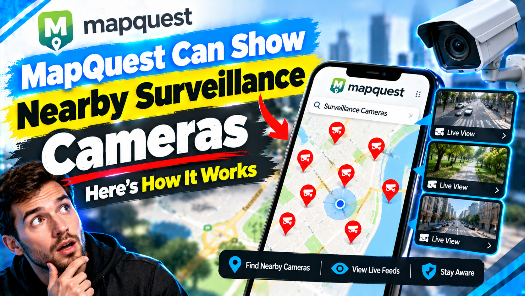
A familiar mapping service can now reveal something many drivers rarely notice: the roadside cameras capable of recording license plates. MapQuest’s surveillance layer allows users to explore the reported locations of certain public-facing surveillance devices, including some Flock Safety cameras and other automatic license plate readers where coverage is available.
The feature effectively turns MapQuest into a public camera surveillance map. Open the appropriate layer, zoom into a covered area, and markers may appear near intersections, neighborhood entrances, parking areas, or major roads. Selecting a marker can provide available details about the reported device, such as its category, manufacturer, or approximate location.
That does not mean MapQuest can display every camera, confirm that each mapped device is operational, or reveal live footage. The MapQuest surveillance layer is a discovery tool built around reported location data—not a real-time window into private or government camera networks. Understanding that distinction is essential when interpreting what appears on the map.
What Is the MapQuest Surveillance Layer?
The surveillance layer is an optional map overlay designed to identify certain publicly reported surveillance devices. Its most notable entries are automatic license plate readers, commonly called ALPRs, that photograph passing vehicles and convert visible plate numbers into searchable data.
Flock Safety camera locations are a major focus because the company’s solar-powered, pole-mounted readers have become common around neighborhoods, businesses, schools, and public roads. Depending on the underlying record, the map may also identify ALPR technology associated with vendors such as Motorola Solutions’ Vigilant platform or Rekor. Other entries may be labeled generically when the manufacturer is unknown or has not been confirmed.
The current layer should not be confused with a comprehensive map of all MapQuest surveillance cameras. It generally does not catalog every doorbell camera, indoor security system, police body camera, traffic-management camera, or privately operated CCTV device. Manufacturer labels and camera categories are only as reliable as the source information attached to each record.
At publication time, coverage is concentrated in the United States and varies considerably among states, cities, and neighborhoods. MapQuest presents publicly available and community-reported location information rather than direct, real-time telemetry supplied by every camera operator. Records may originate from public disclosures, open-source research, observations, or crowdsourced reporting. Users should check any source or attribution information shown with an individual marker instead of assuming that all entries were collected in the same way.
How to Find License Plate Reader Cameras on MapQuest
The precise wording and placement of controls can differ between MapQuest’s website and mobile experience, and interface updates may be released gradually. The basic process is straightforward:
- Open the current MapQuest website or update the mobile app if the feature is supported in your version.
- Enter a city, street, ZIP code, or neighborhood to center the map on the area you want to examine.
- Open the map layers or overlay menu and look for the surveillance or surveillance-camera option.
- Enable the layer, then zoom in. Camera markers may not appear at a broad state or regional view.
- Select an individual marker to review its available classification, manufacturer, reported position, and other supplied metadata.
- Compare nearby roads, intersections, entrances, and landmarks to understand where the device was reported.
If the overlay is not visible, that does not prove there are no surveillance cameras near you. The feature may not yet be available in that interface, or MapQuest may have no mapped records at the selected zoom level. Trying a current browser, checking for an app update, or searching a nearby city can help determine whether the issue is availability or local coverage.
How to Interpret a Flock Cameras Map Marker
A marker is best understood as a report that a device was observed, disclosed, or documented at or near that location. It is not proof that the camera remains installed, is powered on, or is currently uploading data.
Installation details can change quickly. Cameras may be moved, replaced, damaged, temporarily deployed, or removed after a contract ends. Crowdsourced positions can also be slightly inaccurate, particularly when a camera is recorded from a moving vehicle or placed along a road without an obvious address.
A marker likewise does not establish ownership. Neighborhood surveillance cameras may be purchased by a homeowners association, business, school, property manager, police department, sheriff’s office, or municipal government. Some privately funded systems permit law enforcement searches, while others do not. A camera standing beside a public road is not necessarily owned or operated by a public agency.
MapQuest also does not provide public access to a camera feed merely by mapping its reported position. Most ALPR systems capture still images and plate-related records for authorized account users; they are not public webcams. The layer shows possible license plate reader locations, not the images, searchable plate histories, account permissions, or current network status behind those devices.
How Automatic License Plate Readers Work
Automatic license plate readers use a camera, illumination hardware, and optical character recognition software to detect vehicles and extract visible plate characters. A fixed reader may monitor vehicles traveling through a particular lane or entrance. Mobile systems can be attached to police vehicles, parking-enforcement cars, trailers, or other platforms.
Although capabilities vary by product and operator, an ALPR record commonly includes:
- An image of the vehicle or its rear area
- The plate number interpreted by the software
- The date and time of the observation
- The camera’s location or geographic coordinates
- The vehicle’s direction of travel
- Potential vehicle characteristics, such as make, model, color, or distinguishing features
This answers an important question: what data do license plate readers collect? They generally collect more than a plate number. When time and location are attached, each record documents that a particular vehicle was observed at a particular place. Multiple observations can form a history of movement even when no traffic violation or crime occurred.
Operators may compare observed plates against hot lists containing stolen vehicles, missing-person alerts, wanted vehicles, or plates connected to an investigation. A match can generate an alert for an authorized user. Investigators may also search historical records, subject to system settings, agency rules, contractual terms, and applicable law.
Storage, Sharing, and License Plate Tracking Privacy
Data retention is not uniform. Records might be deleted after a short period or stored longer under an operator’s policy. Access may be limited to one organization, shared with selected agencies, or made searchable through a broader network. Laws and court requirements also differ by jurisdiction.
Anyone evaluating MapQuest privacy features should therefore look beyond the marker itself. The map may help identify the likely device, but it usually cannot answer every question about the database behind it. Useful follow-up questions include:
- Who owns and administers the camera?
- How long are plate records retained?
- Can other agencies or private organizations search them?
- Are searches audited, and is a case number required?
- Can data be exported to third parties?
- What procedures apply to incorrect plate matches?
- Can the operator disclose aggregate usage and sharing statistics?
Agency policies, procurement contracts, city meeting records, public-records responses, and vendor transparency pages may provide answers. The Electronic Frontier Foundation’s ALPR overview also explains the technology and the civil-liberties issues it raises.
Why Law Enforcement and Communities Use ALPR Cameras
Supporters argue that license plate recognition cameras can quickly turn a routine vehicle sighting into a useful investigative lead. An alert may help officers locate a stolen car, identify a vehicle associated with an abduction, or find a suspect vehicle described by a witness. Historical searches can also help investigators determine whether a vehicle was near a relevant location.
Compared with continuously staffing an entrance or manually reviewing hours of video, automated searches can save time. Businesses and residential communities may view cameras as a deterrent or as a way to provide evidence after vehicle thefts, burglaries, or property crimes.
However, an ALPR match is not the same as proof of wrongdoing. Plates can be misread, duplicated, stolen, or attached to a vehicle driven by someone other than its registered owner. Responsible use requires confirmation, appropriate access controls, staff training, and limits on how an alert is treated.
ALPR Privacy Concerns and the Flock Safety Controversy
The central criticism is that public surveillance technology can record the movements of large numbers of people who are not suspected of a crime. A camera may capture visits to homes, medical facilities, houses of worship, political events, support groups, or workplaces. When observations from many locations are retained and searchable, they can reveal sensitive patterns.
The Flock Safety privacy controversy reflects broader concerns about networked ALPR systems: retention periods, cross-agency searches, third-party access, cybersecurity, inaccurate watch-list entries, and uses that expand beyond the original reason for installation. Critics also question whether residents receive meaningful notice before neighborhood surveillance cameras are deployed.
Supporters respond that cameras observe vehicles traveling in visible locations, that retention can be limited, and that audit logs can discourage improper searches. The strength of those safeguards depends on actual policy and enforcement. A written rule matters only if access is monitored, violations have consequences, and sharing arrangements are transparent.
This is why the debate over surveillance technology and civil liberties cannot be resolved simply by counting cameras. The more important issues are who can search the resulting data, for what purpose, for how long, and under what oversight.
Practical Steps for Checking Cameras and Policies
People searching for surveillance cameras near me can use MapQuest as a starting point, then verify what they find through additional research:
- Record the marker’s reported manufacturer, category, and location without assuming it is current.
- Check the physical area only from places where you are legally allowed to be; do not touch, obstruct, or interfere with equipment.
- Search local council agendas, police policies, contracts, and procurement records for the named vendor.
- Review the operator’s privacy policy, retention schedule, sharing rules, and public-records process.
- Ask whether mapped cameras are active, who controls them, and whether outside organizations have access.
- Recheck the layer periodically because reported locations and metadata may change.
A mapped device should be treated as a lead to investigate—not definitive evidence about current collection or sharing practices.
Frequently Asked Questions
Does MapQuest show every surveillance camera?
No. Coverage is incomplete and uneven. The layer focuses on certain publicly reported devices and should not be treated as an inventory of every ALPR, traffic camera, doorbell camera, or private security system.
Are all MapQuest Flock cameras operated by police?
No. Flock cameras can be funded or operated by law enforcement agencies, municipalities, businesses, schools, property owners, or neighborhood organizations. Ownership and access must be checked separately.
Does a marker prove that a camera is active?
No. A marker indicates a reported location. It does not confirm that the camera is installed, powered, recording, connected to a network, or sharing data at the time you view the map.
Can users see license plate records through MapQuest?
No. The layer maps reported device locations; it does not provide live feeds, captured images, plate numbers, historical searches, or access to an operator’s ALPR database.
Why might my city have few or no markers?
The area may have limited community reporting, incomplete public disclosures, unsupported device types, or no mapped records yet. An empty map is not proof that the area has no license plate recognition cameras.
The Bottom Line
MapQuest’s surveillance layer makes an often-invisible part of modern infrastructure easier to see. It can help users find reported Flock Safety camera locations and other ALPR installations, learn where coverage appears concentrated, and begin asking informed questions about ownership and data practices.
Its limitations are equally important. The map is not comprehensive, marker positions may be approximate or outdated, and a listed camera is not necessarily active or connected to law enforcement. Used carefully, the layer offers visibility—not certainty—into the expanding relationship between vehicle tracking, public safety, privacy, and civil liberties.